A strengthening El Niño and the emergence of a positive Indian Ocean Dipole are increasing the likelihood of a drier-than-average spring. While July rainfall has been close to average across much of the southern Basin, the seasonal outlook suggests opportunities for meaningful inflows may become increasingly limited in the months ahead.
July 13, 2026 | The Basin Brain
The Southern Murray-Darling Basin has entered one of the most important periods of the water year, with winter rainfall now determining inflows into major storages ahead of the 2026–27 irrigation season. While rainfall during the first half of July has generally tracked close to average across much of the Basin, the broader climate outlook is becoming increasingly concerning.
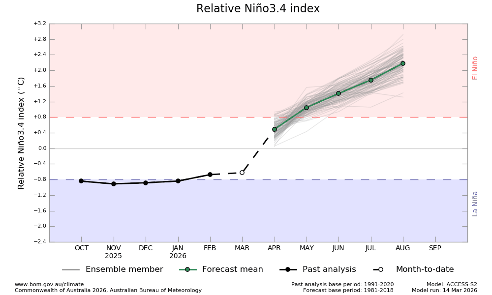
The most significant development since our previous update has been the continued strengthening of El Niño, with the Niño3.4 index now well above the El Niño threshold and forecast to strengthen further through spring. Current modelling suggests sea surface temperatures in the central Pacific could exceed 3°C above average by late spring—an exceptionally strong signal by historical standards.
While El Niño does not guarantee dry conditions, it significantly increases the probability of below-average winter and spring rainfall across eastern and southern Australia, particularly when supported by other climate drivers.
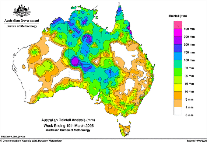
Rainfall during the first half of July has been close to average across much of the southern Basin, although western Victoria, South Australia and parts of western Western Australia have remained drier than normal. In contrast, parts of inland Queensland and central Australia have recorded above-average rainfall. From a water supply perspective, the near-average rainfall across many southern catchments has helped maintain soil moisture, but widespread runoff-producing events have remained limited.
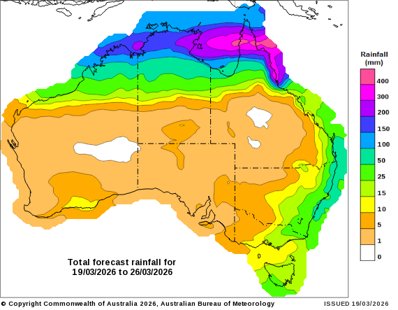
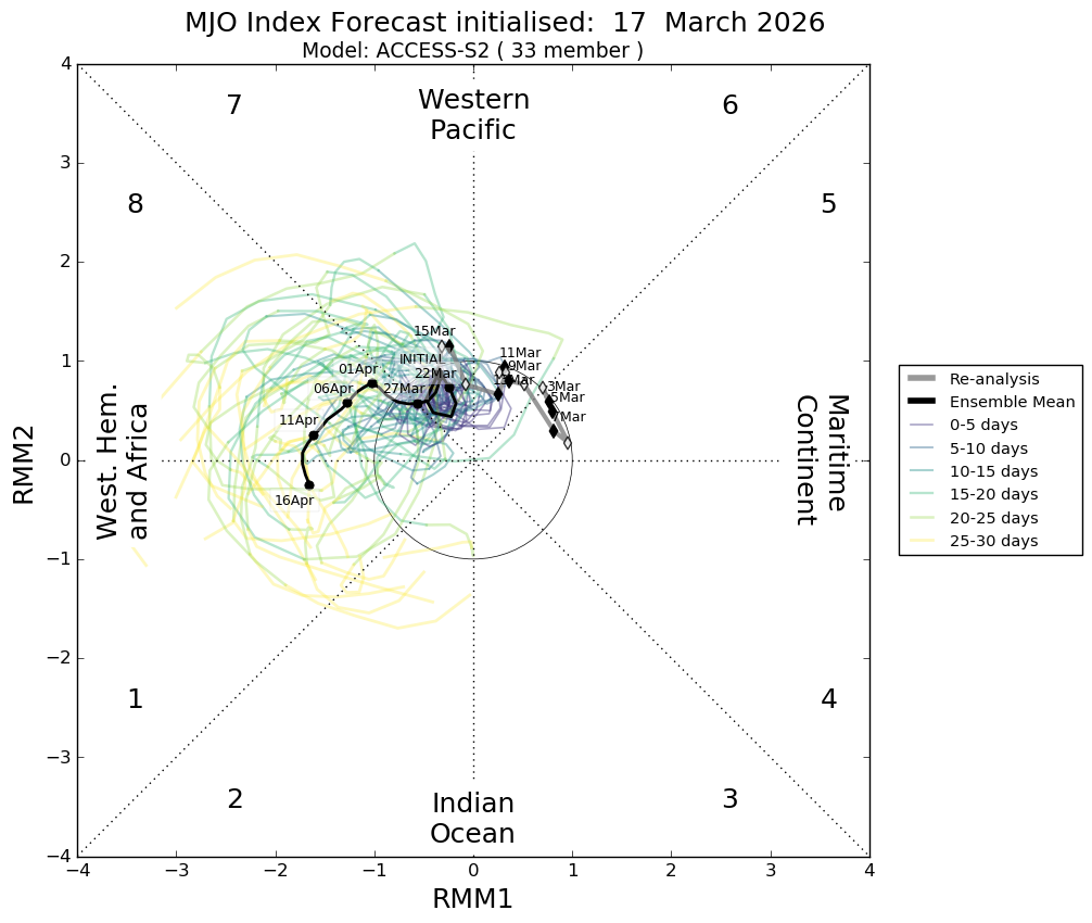
The short-term outlook through the remainder of July remains relatively neutral. The Madden-Julian Oscillation (MJO) is currently active over the western Pacific and is forecast to weaken as it moves through phases 6 and 7 during the coming fortnight. At this time of year, the MJO generally has a weaker influence on southern Australia’s rainfall than during the warmer months, meaning its impact on winter frontal activity is expected to be limited.
Looking further ahead, the seasonal outlook paints a more challenging picture.
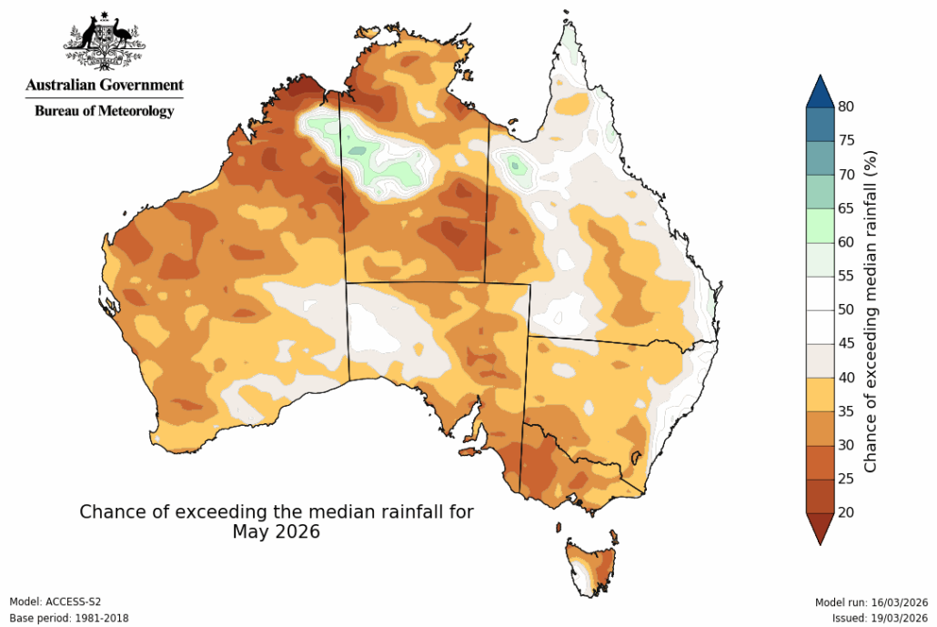
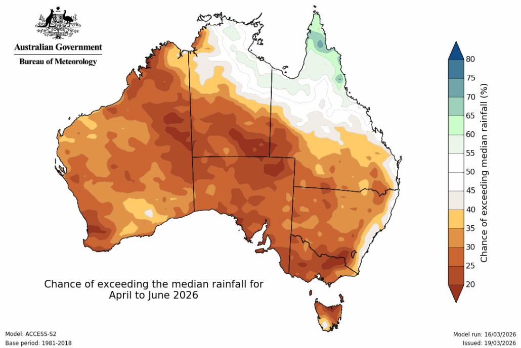
For August, rainfall probabilities across much of the Murray-Darling Basin remain close to historical averages, suggesting no strong indication toward either wetter or drier than normal conditions. While this provides some opportunity for useful rainfall events, confidence in above-average winter rainfall remains relatively low.
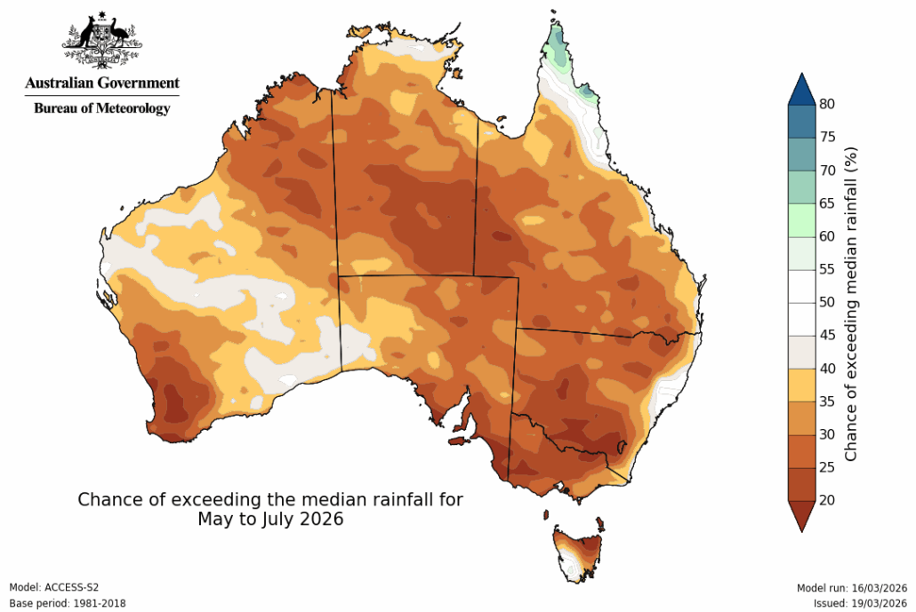
The outlook deteriorates more noticeably into September, with much of eastern Australia—including large areas of New South Wales and Victoria—showing only around a 20–35% chance of exceeding median rainfall. This represents a clear shift toward below-average rainfall probabilities during what is traditionally one of the most important months for inflow generation.
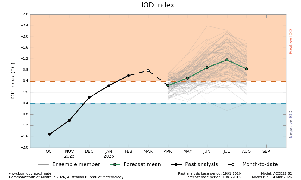
Another emerging climate driver is the Indian Ocean Dipole (IOD). Current observations indicate the IOD is hovering near positive thresholds, with forecast models maintaining a weak to moderate positive event through spring. A positive IOD historically suppresses moisture transport from the Indian Ocean into southern Australia and, when combined with El Niño, often reinforces dry conditions across the southern Murray-Darling Basin.
Taken together, the major climate drivers are becoming increasingly aligned. A strengthening El Niño, the development of a positive IOD, and a weakening influence from tropical variability all point toward an increased likelihood of below-average rainfall through late winter and spring.
From a water supply perspective, these signals warrant close attention.
The Basin enters the second half of winter with storages still heavily reliant on seasonal inflows. While rainfall so far this month has prevented further deterioration in catchment conditions, significant storage recovery will require a number of widespread frontal rainfall events over the coming eight to ten weeks.
If the current seasonal outlook verifies, opportunities for these events may become increasingly limited. This would place greater pressure on existing water reserves and increase the importance of efficient water management decisions heading into the 2026–27 irrigation season.
Although climate outlooks remain probabilistic rather than deterministic, the balance of evidence has shifted further toward a drier-than-average spring. As always, individual rainfall events can still occur, but the broader climate drivers now suggest they are likely to become less frequent and less reliable as the season progresses.